
12:29PM, Tuesday 28 January 2025

Stock picture of a flood warning sign.
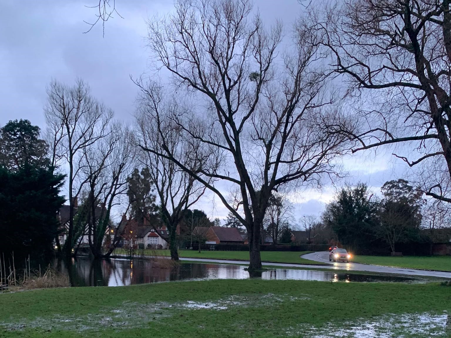
The Environment Agency has issued flood alerts for waterways around the Royal Borough of Windsor and Maidenhead – as further heavy rainfall is expected this week.
Amber alerts are in place for the River Thames, The Cut, Lower River Loddon and Colne Brook which warn flooding of low lying land and roads is possible
Residents and people using land around rivers and streams are urged to use caution and ‘be prepared’ if the waterways do burst their banks.
River Thames:
Alerts have been issued for the Thames between Hurley and Cookham, covering: Bisham, Marlow and Bourne End; and stretching westwards to Sonning.
The EA said more heavy rainfall is expected today (Tuesday) with ‘unsettled’ weather conditions lasting until Thursday. It added River Thames water levels were ‘rising slowly’ and are forecasted to continue.
River levels downstream of Cookham Lock have risen more than 25 cm to reach 39cm in the past 24 hours. A water level above 60cm here means flooding is likely.
River Thames at Maidenhead remains steady, although it has risen more than 30cm since Sunday to reach 2.97m. 3.55m is the maximum ‘normal range’ for this location.
The EA has said people should avoid using low-lying footpaths beside waterways as these may be liable to flood.
The Cut:
Flooding in Holyport earlier this week (picture: Tessa Hastings).
Water levels at The Cut have fallen following heavy rainfall since Sunday, though a flood alert remains in place covering Holyport, and Bray.
The EA is still advising caution as, it says, river levels ‘will remain sensitive to any further rainfall’.
The Cut’s level at The Binghams reached 10cm over its normal range of 1.7m yesterday but has since receded below this limit.
As of this morning, the level was 1.62m.
The Lower River Loddon:
The River Loddon at Twyford has exceeded the top of its normal range by 30cm and is now 2.56m.
The waterway has risen more than 50cm since Sunday morning, and is continuing to rise.
Flooding of low lying roads and land is expected, the EA says, and may worsen given heavy rainfall is forecast throughout the week.
Alerts are in place for the River Loddon covering: Charvil, Paley Street, Twyford and Waltham St Lawrence.
Colne Brook:
River levels at Colne Brook are expected to remain high until Wednesday and an alert is in place covering: Colnbrook, Iver, Old Windsor and Wraysbury.
The Environment Agency said people should avoid walking or driving through flood water and use its data to monitor water levels, with more rainfall expected.
It expects the most affected areas to be around Colnbrook Village, Poyle and Albany Park – although no property flooding is predicted at this stage.
A monitoring station at Horton Mill recorded a level of 0.35cm this morning – less than 10 cm from the top of its normal range.
View the Environment Agency’s flooding service map for the latest information.
Water level data is recorded using a fixed point in the River Thames which rises and falls are measured against.
Most read

Archive image of the entrance to Newlands Girls' School (Google)
Top Articles

It’s the ‘end of an era’ for Maidenhead Golf Club after members played a final round at their Shoppenhangers course before moving off.

Archive image of the entrance to Newlands Girls' School (Google)
A former head of music at Newlands Girls’ School in Maidenhead has been banned from teaching indefinitely over a litany of ‘sexually motivated’ advances on students.

Liverpool Football Club jerseys, red balloons and ribbons adorned streets across the town to commemorate Reuben Virdee, 11, who passed away earlier this month.
© Copyright 2024 Baylis Community Media CIC All right reserved


